Import KMZ/KML boundaries and read the project area without manual coordinate cleanup.
Windows desktop • UAS survey planning • KMZ/KML to deliverables
Turn AOIs into survey-ready GCP/VCP packages.
UAS Survey Tool loads KMZ/KML areas of interest, supports terrain-aware DEM/DSM workflows, generates GCP/VCP layouts, and exports field-ready deliverables for drone mapping and survey planning.
KMZ/KMLAOI loading and parsing
GCP/VCPLayout generation and review
ExportsCSV, KML/KMZ, PDF reports
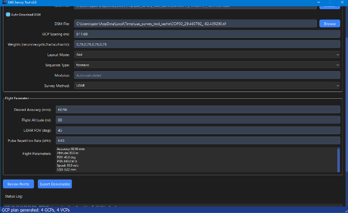
Built around the survey planning flow.
The app takes a mapping boundary from import to terrain review, point layout, quality checks, and exportable field documents.
Use DEM/DSM inputs or OpenTopography-assisted downloads when a user provides their own API key.
Create GCP and VCP locations using spacing, layout mode, sequence type, and survey-method parameters.
Save point lists, KML/KMZ overlays, terrain visuals, and PDF reports for field review.
Practical UAS survey automation with operator control.
The tool keeps the operator in control. It calculates and visualizes candidate points, then lets the user review, edit, save, and export the final package.
ImportKMZ/KML AOI files and derive the survey boundary.
EvaluateEstimate area, elevation range, spacing, and method inputs.
GenerateProduce GCP/VCP candidates from configured layout parameters.
ReviewInspect points visually and adjust density or individual markers.
ExportCreate field files, point lists, reports, and Google Earth overlays.
DocumentProduce a repeatable PDF report with terrain and compliance context.
Where it saves time.
Designed for UAS pilots, survey technologists, construction mapping teams, and geospatial workflows that repeatedly convert boundaries into survey-ready control plans.
1
Point planning
Generate GCP/VCP layouts from an AOI with configurable spacing, layout mode, and survey method.
2
Terrain context
Review DEM/DSM-derived terrain information, elevation profile output, and 3D terrain model report sections.
3
Field handoff
Export point tables, Google Earth overlays, and PDF reports that can be reviewed before field collection.
Product screens.
Click any screenshot to open the full-size view. Sensitive source path text in the report screenshot has been redacted.
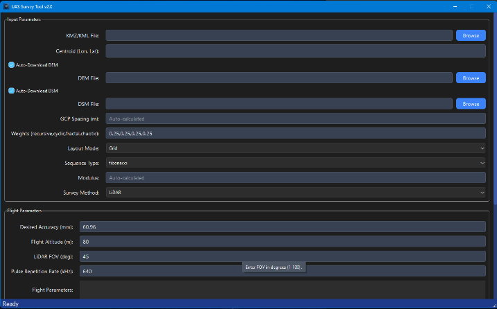
Input Parameters
Load KMZ/KML boundaries, configure DEM/DSM options, spacing, layout mode, and LiDAR flight parameters.
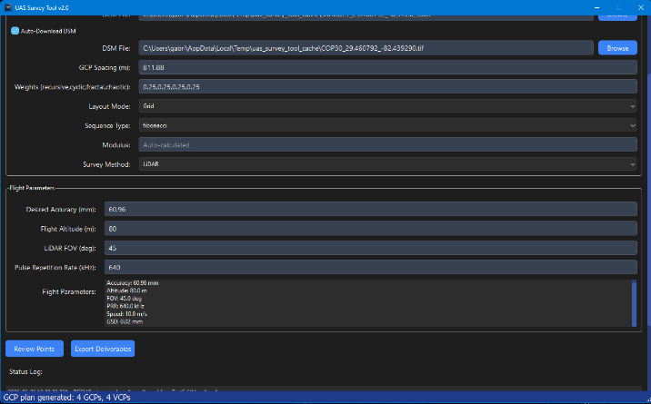
Generated Plan
Generate GCPs and VCPs with point counts, spacing, flight values, and export controls.
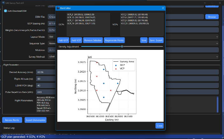
Point Editor
Review the survey area and point distribution before saving or exporting.
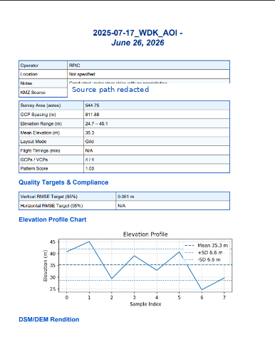
PDF Report
Generate survey summary reports with quality targets, elevation profile, and project metadata.
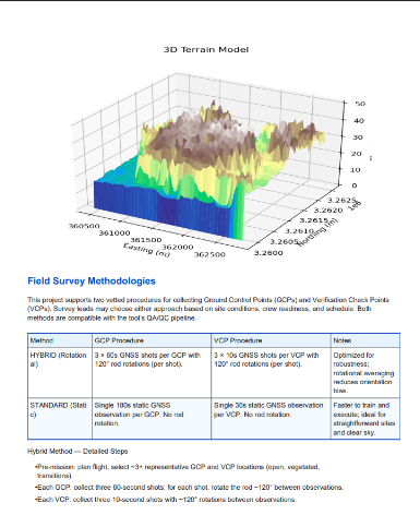
Terrain Model
Include terrain model visuals and field survey methodology sections in the report output.
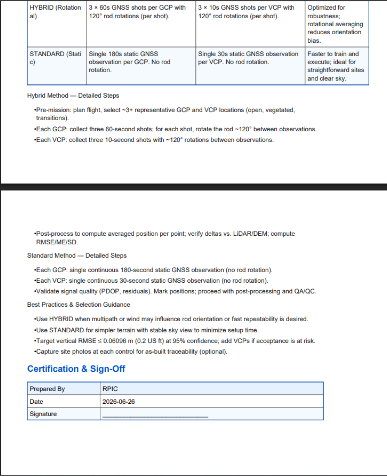
Methodology and Sign-Off
Document control collection procedure, quality checks, and certification sign-off space.
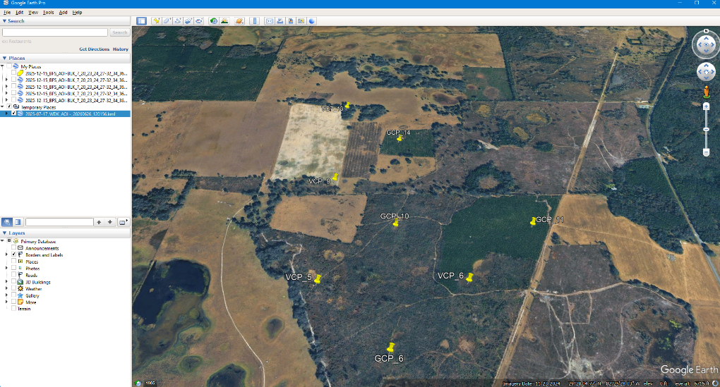
Google Earth Overlay
Open exported points and labels in Google Earth for spatial review and field coordination.
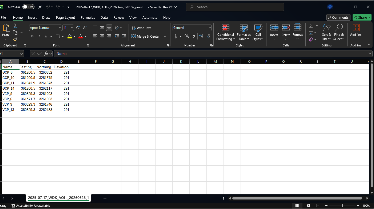
Spreadsheet Export
Export point names, eastings, northings, and elevations for downstream field workflows.
Portable Windows release.
The release is distributed as a portable ZIP. Users download, extract, open the folder, and run the EXE. They do not need Python, Conda, Git, GDAL, Rasterio, PyQt, or command-line setup.
Download ZIP
→ Extract folder
→ Open UAS_Survey_Tool_v2
→ Run UAS_Survey_Tool_v2.exe
→ Enter OpenTopography key if needed
Bring your own terrain key.
The app does not ship with a shared OpenTopography API key. DEM/DSM download workflows require the user to provide their own key when prompted.
Not included:
- shared OpenTopography key
- company project data
- private KMZ source files
- local cache files
Download UAS Survey Tool v2.0.
Use the portable Windows ZIP for normal users. Use the GitHub repository if you want to inspect the Python source, build files, release notes, and packaging configuration.
Do not run the EXE directly from inside the ZIP. Extract the ZIP first, then run UAS_Survey_Tool_v2.exe from the extracted folder.