WX // FORECAST
Weather and hourly conditions
Wind, gust, temperature, humidity, precipitation, cloud cover, visibility, and forecast-driver context.
AeroClear unifies weather, GNSS and Kp context, nearby cooperative crewed-aircraft awareness, terrain, aircraft limits, optimal launch windows, reporting, and aviation information integrated through FAA SWIM data services into one responsive preflight intelligence surface.
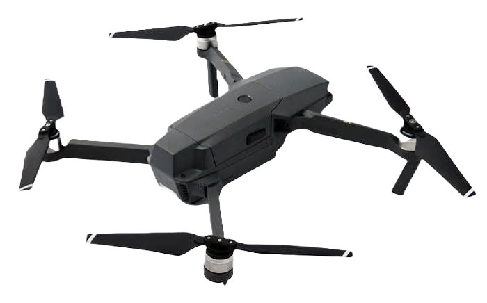
AeroClear is built for pilots who need more than a generic weather tile. Mission parameters, aircraft limits, source state, terrain, traffic context, launch windows, and reporting remain connected as one planning model.
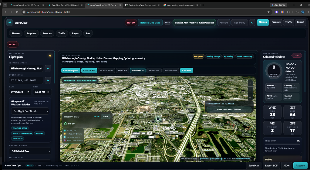
AeroClear keeps operational context visible and separates planning assistance from regulatory authority. The pilot in command remains responsible for the decision.
Wind, gust, temperature, humidity, precipitation, cloud cover, visibility, and forecast-driver context.
Kp and satellite context presented beside mission thresholds instead of isolated in another planning app.
Nearby cooperative traffic context with explicit provider status and honest zero-target, degraded, or unavailable states.
Terrain, AOI tools, route layers, altitude context, and object inspection keep planning anchored to real geography.
Profiles and mission variables for wind, temperature, altitude, GNSS margin, and operating constraints.
Structured reports, JSON and HTML exports, source freshness, critical drivers, and mission evidence packets.
AeroClear reduces context switching while keeping source uncertainty visible and regulatory authority distinct.
Search a location, define coordinates or an AOI, select aircraft, altitude, mission mode, and operating limits.
Compare weather, GNSS/Kp, terrain, traffic context, and mission thresholds across the forecast horizon.
Inspect critical drivers, select a launch window, complete preflight review, and export the decision record.
AeroClear exposes provider status, coverage context, and degraded or zero-target states so nearby cooperative-aircraft information stays interpretable in context.
Use traffic context alongside visual scanning, official procedures, and pilot-in-command responsibility, with provider coverage and latency visible in the decision record.
Use the core planning workflow first, then unlock the complete paid capability set for recurring and advanced mission planning.
Evaluate a mission and experience the core AeroClear workflow before upgrading.
Unlock the complete paid AeroClear capability set for recurring and advanced mission planning.
AeroClear supports UAS planning alongside regulatory authorization, pilot judgment, official airspace sources, required weather briefings, aircraft manuals, site-specific risk assessment, and required preflight procedures. Provider coverage and status remain visible when interpreting nearby traffic data.
AeroClear is a responsive UAS mission-planning and preflight intelligence platform from SALT19.
It supports planning alongside regulatory authorization, official sources, required briefings, and pilot judgment.
Yes. AeroClear is designed for responsive planning across desktop, tablet, and mobile browsers.
Use provider-status-aware traffic context alongside visual scanning, official procedures, and pilot-in-command responsibility.
Turn weather, terrain, GNSS, traffic context, aircraft limits, and launch windows into one reviewable preflight picture.
AeroClear integrates data services from FAA System Wide Information Management (SWIM) to broaden the aviation context available to UAS mission planning alongside weather, GNSS/Kp, terrain, aircraft limits, cooperative traffic awareness, launch-window analysis, and reporting.
This does not make AeroClear an FAA authorization service or certification and does not replace official regulatory sources, required authorizations, pilot judgment, visual scanning, aircraft manuals, or Remote Pilot in Command responsibility.